ODUNPAZARI
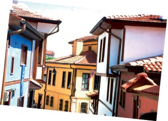
Odunpazarı is the first area of Turkish settlement in Eskişehir. After taking Karacahisar, Turks established a new town in Odunpazarı, facing the Dorylaion (Şarhöyük) where the Byzantine landlords were living. As Sultan Kılıç Arslan I established a headquarters here in 1907 during the Dorylaion War, Eskişehir had been referred to as “Sultanyügi”. Odunpazarı reflects the Turkish-Islamic culture and civil architecture trends of the past. The earliest building in the district is the Alaeddin Mosque which dates back to the 13th century. Odunpazarı, referred to as “Sultan Önü” as of the 14th century, demonstrates the Seljuk and Ottoman States’ efforts to create a traditional structure. Following the fires in the downtown in 1905 and 1922, commercial and public buildings were mostly moved to Odunpazarı. Firewood (“odun” in Turkish) was sold in an area close to Yediler Park, and that is why the district has been called Odunpazarı (Bazaar of Firewood).
The historical Odunpazarı district consists of the following parts: Akarbaşı, Akcami, Akçağlan, Cunudiye, Şarkiye, Paşa, Orta, Alanönü and Dede. Akcami and Dede are the neighborhoods that mainly preserve their historical and traditional characteristics. With its narrow streets, houses, mosques, fountains, little squares and Kurşunlu Külliyesi, Odunpazarı has always been a very special location, e.g. in transition from the age of principality to emperorship, during the War
of Independence and from the proclamation of the Republic to our day. Further, you can see the traces of the 1st National Architectural Movement in the buildings of Atatürk High School and Museum of the Republican History. Declared as a “protected area”, Odunpazarı turns into a living area owing to the restoration works of Odunpazarı Municipality. With its well-protected houses, narrow streets, museums and mosques, Odunpazarı shows you a different face of Eskişehir.
Odunpazarı Evleri

Odunpazarı is known for the old houses that constitute good examples of the civil architecture. The houses mostly face the street, are adjacent to each other, and have gardens. The front sides facing the street have bay windows and consoles. The houses generally comprise a sofa (hall) and other rooms surrounding it. They are planned as two parts, i.e. the ground floor allocated for service and the upper floor designed as the living space. The corner room on the front side of houses, with windows on two sides, is larger and more important than others. The walls of ground floor are usually made of rubble or adobe with bonding timbers. Timber materials are used to build the upper floors, and adobe is used to fill the spaces in timber materials.
In Odunpazarı district, there are some other houses that constitute good examples of integration with the historical structure and loyalty to the old architecture. These houses face the Odunpazarı Square, and are also seen from the main road. These reinforced concrete houses were built on the basis of the models of the historical Odunpazarı houses within the cultural center project of Eskişehir Metropolitan Municipality. The house completed first now serves as the Museum of Contemporary Glasswork. The district has become a new living space with varying food and accommodation alternatives.
Kurşunlu Külliyesi
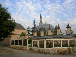
Kurşunlu Külliyesi (Complex) dates to the 16th century. Çoban Mustafa Pasha, one of the viziers of the Ottoman State, had it built in 1517. According to the records in the Archives of Topkapı Palace Museum, Çoban Mustafa Pasha had all buildings in the Külliye, excluding the Great Caravanserai, constructed between 1517 and 1525; and probably the Külliye was completed in 1525. The architect of Kurşunlu Külliyesi was probably Acem Ali, who was the chief architect preceding Mimar Sinan. Acem Ali, whose real name was Alaeddin Ali Bey and who is also known as Acem Alisi or Esir Ali, was the first known chief architect of the classical Ottoman architecture (1519-1537). The Külliye comprises the mosque, şadırvan (fountain), zaviye (medrese), talimhane (building for education), harem, imaret (almshouse), tombs of Mevlevi sheikhs and two caravanserais.
YAZILIKAYA
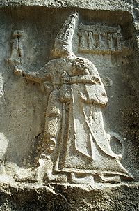
The monument is located in the south end of Yazılıkaya Valley and in the west of Yazılıkaya Village. It was built on Yazılıkaya Plateau which consists of steep tuff rocks. It was a settlement area protected by Akpara, Pişmiş, Gökgöz and Kocabaş Fortresses which were located at higher positions to control the routes from the west and the north. The length of the monument is 650 m and the width is 320 m. Its altitude from the valley is 60-70 m. It is thought to have been surrounded with walls in the Phrygian Period. Today there are
no stones left from this wall. However, there are some foundation slots in the form of steps on some parts of the rocks surrounding the area like a natural fortress wall. These slots make us think that there were some fortifications in some of the slots.
.jpg) The main entrance of the city is in the east. The sloped road which leads to the main rock is known as the Royal Road. There are some figurative reliefs on the rocks that constitute the borders of the road. The important buildings of the area are the altars with steps carved on the rocks, two rock tunnels with rocky steps and covered with vaults, and the monumental rock cisterns in the below terrace. There are a lot of cult buildings and sepulchral chambers which involve monumental facades, altars with steps and niches on the huge steep volcanic rocks that surround the settlement. This area is of special importance owing to many colossal religious monuments. This shows that the city of Midas was the religious metropolis of the region and was respected as a sacred city by the Phrygians. In Phrygia, the capital city Gordion was the political center of the government, and Midas city was an important religious center as of the establishment of the kingdom. After the political collapse of the kingdom, Midas was not evacuated. The Phrygian rock buildings continued to be used in the Hellenistic and Roman Periods. The archaeological site of Yazılıkaya, which was nominated to be included in the World Cultural and Natural Heritage List, resists all the negative external effects with its unique rock monuments.
The main entrance of the city is in the east. The sloped road which leads to the main rock is known as the Royal Road. There are some figurative reliefs on the rocks that constitute the borders of the road. The important buildings of the area are the altars with steps carved on the rocks, two rock tunnels with rocky steps and covered with vaults, and the monumental rock cisterns in the below terrace. There are a lot of cult buildings and sepulchral chambers which involve monumental facades, altars with steps and niches on the huge steep volcanic rocks that surround the settlement. This area is of special importance owing to many colossal religious monuments. This shows that the city of Midas was the religious metropolis of the region and was respected as a sacred city by the Phrygians. In Phrygia, the capital city Gordion was the political center of the government, and Midas city was an important religious center as of the establishment of the kingdom. After the political collapse of the kingdom, Midas was not evacuated. The Phrygian rock buildings continued to be used in the Hellenistic and Roman Periods. The archaeological site of Yazılıkaya, which was nominated to be included in the World Cultural and Natural Heritage List, resists all the negative external effects with its unique rock monuments.
SİVRİHİSAR
Sivrihisar is the biggest district of Eskişehir. The town center is at the intersection point of Ankara, Eskişehir and İzmir highways. It stands out with its sharp pointed rocks located on the skirts of a rock mass which is an extension of Mount Çal. The town is named after these rocks. In Hisarönü-Balkayasi area of the rocks, Eskişehir Museum of Archaeology found a rock painting. On the surface of the rock is a scene with figures of a horse, man and dog painted in red.This painting dating back to the Chalcolithic Age is significant in that it is the first and the only painting as such not only in Sivrihisar but also in the Central Anatolia. Archeological studies point out the fact that Sivrihisar has been densely populated during the Bronze Age. The region was also the main settlement of the powerful kingdom of Phrygians in the Iron Age. On the rocky slopes of Sivrihisar Mountains are beautiful samples of the Phrygian settlement and rock monuments. Pessinus (Ballıhisar), founded by the Phrygian King Midas, is also located here. The famous Persian Royal Road was passing through Pessinus.
The town maintained its commercial and military importance during the Roman and Byzantine periods. The fortress to the northwest of the town center and the settlement area on the foothills of this fortress was called Spaleina. Sivrihisar fell under the hegemony of Seljuks in 1074. A reconstruction movement started in the town, which was called Karahisar, and many buildings such as mosques, medreses and hamams were constructed.
Following the collapse of the Anatolian Seljuk Empire in 1308, this region fell under the control of Ilkhanids. With the decreasing influence of the Ilkhanid State in the Anatolia, the Turkmen principalities declared their independence. This area remained within the borders of Germiyanoğulları principality based in Kütahya. It was a town of the province of Ankara during the reign of Sultan Murad I. In 1912, Sivrihisar became a district of Eskişehir. The district occupied by the Greeks gained its independence on September 20, 1921.
Nasrettin Hoca's Home:
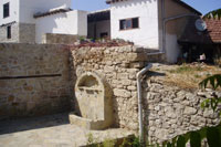
Famous humor master Nasrettin Hoca was born in Hortu Village of Sivrihisar in the year of 605 (1208-1209). He had got his first education from his father who was the imam of the village. After then, he had got education from the omniscents and wise men such as Seyyid Mahmud Hayrani and Seyyid Hacı Ibrahim by going to Akşehir.
It is also thought that Nasrettin Hoca studied in Konya Medrese, gave education in Akşehir and Sivrihisar and also was imam and orator there. Additionally, his death is dated to 683 (1284) on an old grave stone that is supposed to belong to Nasrettin Hoca. His grave is in Konya, Akşehir.
Nasrettin Hoca is a folk philosopher who is famous in the whole world with his name, intelligence and his anecdotes. Since his witty remarks in his life, nature and society that is animated with his sharp thoughts and clever sayings are in the capacity of satisfying not only one nation but also all humankind, this Turkish intelligence is known and loved by all other nations. And Turkish intelligence has found its own humor style and loved, spread, united and increased. Nasrettin Hoca anecdotes are also translated into languages of west. Nasrettin Hoca is a famous humor master who is also known in countries such as Iran, Egypt, Iraq and in Kafkas, Balkan Countries and Europe countries.
Karakaya Tomb .jpg)
Just beside the village cemetery there is a sepulchral chamber engraved in a volcanic rocky area, which is a typical example of the Phrygian rock tombs. The tomb consists of two rooms with a saddle roof and a triangular pediment. In the back room there is a grave carved on the main rock. On the high parts of the rocks surrounding the village from north and west, there are two more tombs.
SEYİTGAZİ
The region of Seyitgazi, surrounded by Türkmen Mountain, Kırkız Mountain, Black Mountain and Yazılıkaya Plateau, has a rough topography. The town center is located at the foot of Üçler Hill as well as Seyyid Battal Gazi Külliyesi (Complex of Buildings). The town took its name from this complex.
Archeological studies show that Seyitgazi Region was an intensive settlement area during the Bronze Age. The region was the main settlement area of the Phrygians. Located to the south of Seyitgazi, Yazılıkaya Plateau has genuine examples of Phrygian fortresses and stone monuments.
In the Roman and Byzantine Period, the town became an important business and religious center under the name of Nacoleia. The word “Nacoleia” written on a mosaic found in the region is noteworthy evidence that the town went under this name. Historians report that the Roman Emperor Julian Apostata stayed in Nacoleia while he was on the way to Antiokheia fort he Persian invasion in 361. Procopius, who rebelled against Emperor Valens, was arrested and killed near this city in 366. In the reign of Arkadius (395-408), the Goths invaded the city. Seyyid Battal Gazi, an Islamic hero, was martyred during the Arab invasion in 740 AD. The church records demonstrate that a lot of councils (religious meetings) were held in the city. This area used to be a metropolitan city of Synnada. It became an episcopate in the 10th century. Ruins of the Byzantine Fortress are still found in Kalebayırı. The fortress is seen in a good condition in the 16th -century Ottoman miniatures. Between 1083-1084, the area was ruled by the Danishmends after the attack of Turks.
After the Dorylaion War in 1097, it was excluded from the borders of the Byzantine Empire. It is known that there were religious and military buildings from the Byzantine period; nevertheless, they do not survive today. The column heads and pools of baptism found in Seyyid Battal Gazi Complex prove the existence of these buildings.
After Ümmühan Hatun, the mother of Seljuk Sultan Alaeddin Keykubat I, had a tomb and a mosque constructed around the grave of Seyyid Battal Gazi, the town was named Seyitgazi. Seyitgazi fell under the domination of the Ottoman Empire in 1336. The town gained more importance during the Ottomans as it was one of the stopovers on the route of Istanbul-Baghdad-Hejaz. During the 17th century, it was an ordinary settlement area. It became a district in 1892. The first municipality was founded in 1917. A troop of the town participated in the Independence War. During the Greek invasion, the town was partly damaged. Seyitgazi repelled the Greek army on September 1, 1922.
Seyit Battal Gazi
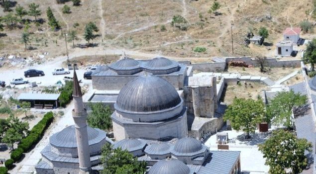
According to the legend, Seyyid Battal Gazi’s grave was found as a result of a dream. Ümmühan Hatun, the mother of Alaeddin Keykubat I, had a tomb and then a mosque built here. The complex was constructed around the tomb. The Ottomans added a medrese, an almshouse, a tekke (dervish lodge) and a dergah (convent of dervishes). Fatih Sultan Mehmet, Beyazıt II and Sultan Selim I restored the buildings and added some other units. During the expeditions to Iran, Kanuni Sultan Süleyman visited Seyitgazi and added some buildings to the complex. On his expedition to Iraq, his army stayed in Seyitgazi and he had Matrakçı Nasuh make a miniature of Seyitgazi. Sultan Murat IV had a caravanserai built here while he was on Revan Expedition. Situated on Istanbul-Baghdad-Hejaz road, Seyitgazi became a stopover for people traveling to Mecca. Thus, the religious importance of Seyitgazi increased.
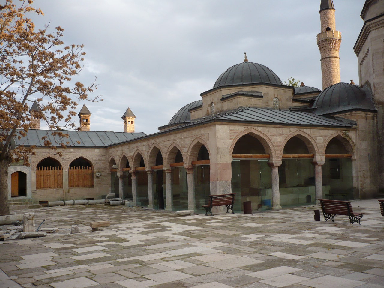
The complex with its medrese became a center to teach Islamic knowledge. It became a center first for Kalenderi Dervishes, and then for Bektashism. It was legendarily said that Hacı Bektaş-ı Veli once visited the complex, and wanted Orhan Gazi to restore the place. Having built houses for 1,000 people, Orhan Gazi made Seyitgazi become a larger settlement area. Thus, the complex became a place to visit for Bektashis. Holding the titles of veli (saint), gazi (veteran) and sayyid (an honorific), Seyyid Battal Gazi became a venerated figure for Muslims from every sect.